West Rim Trail
| Route 66 | Cities | Beaches |
|
West Rim Trail |
|
| Getting There | Lodging | Restaurants | Hiking | Backpacking | The Narrows | The Subway | Springdale |
|
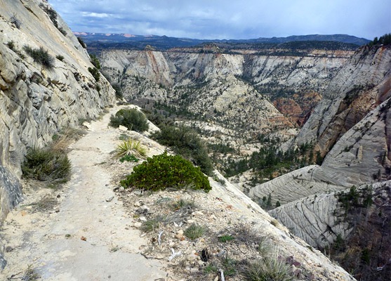
The West Rim Trail is the crown jewel of Zion hiking trails. It is a mix in one trail of every type of scenery Zion has to offer. It's an 18 mile trail that takes two days to hike. It offers everything from mellow grasslands to towering waterfalls to deep gorges to complex rockfaces. The best way to hike it is from Lava Point Trailhead, back to Angel's Landing and The Grotto Trailhead. This direction is slightly downhill most of the way with a few steep descents and only a few brief climbs. Lava Point is in the western side of the park. The easiest way to get there is to pay for a ride on the Zion Adventures shuttle. If you want to drive it yourself, go out the South Entrance, through Springdale, drive to the village of Virgin and take Kolob Terrace Road north back into the park. This 19 mile drive is very scenic. There's a small primitive campground at Lava Point, which at 8000 feet is the highest location in Zion. There's more traffic than you would expect here, because it's also the trailhead for the northern "top down" descent of The Subway. But it's certainly not crowded. |
| East Rim | West Rim | Chinle |
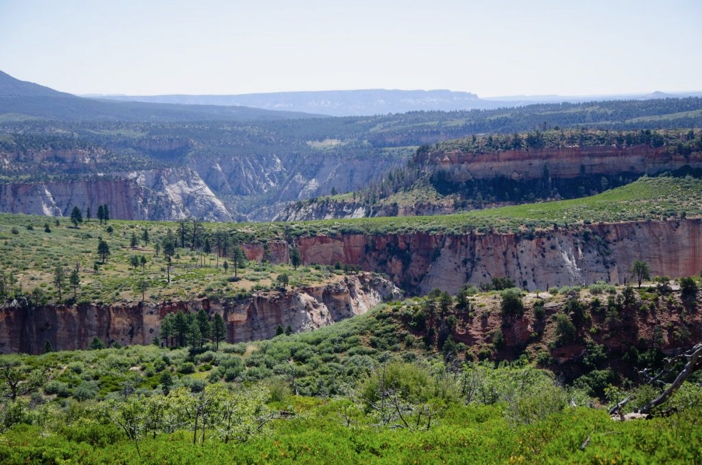
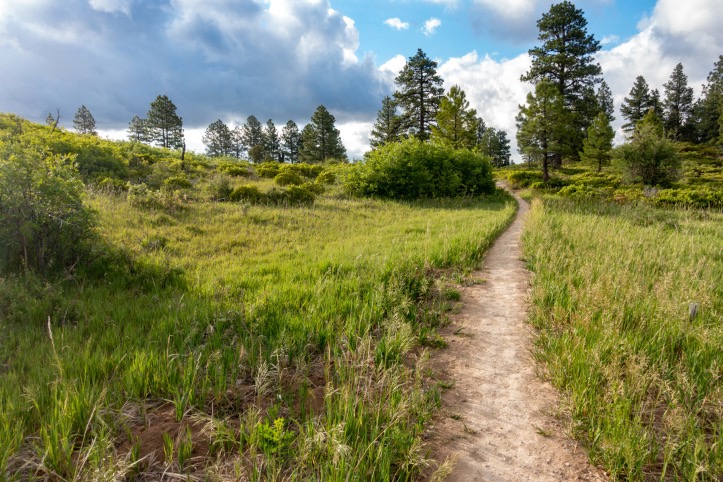
We recommend hiking two miles in and camping at the Sawmill Springs site that first night. Whether you take the shuttle or drive yourself, by the time you stop at the Wilderness Station in the main canyon, wait in line, pick up your permit, stop in Springdale for gas, and find your way out the winding two lane road, it will be afternoon. You're better off to relax, enjoy the surroundings with fine views in all directions, fix a leisurely dinner, and get a good night's sleep, then head out in the morning. You could camp up at the main Lava Point Campground, but this gives you privacy the first night and a two mile head start the next morning. Lava Point itself is not the West Rim Trailhead. That's another mile down the road. But you can't drive your non4WD vehicle down that last stretch of road. West Rim supposedly has water. There are three springs along the trail: Sawmill, Cabin (West Rim) and Potato Hollow. However, Sawmill and Potato Hollow dry up by late June. Only Cabin is reliable. You do have to purify it, but it's cold and there's plenty of it. The Kolob Terrace is slightly cooler than other parts of the park, due to its altitude. But it's still hot, so you still need to carry plenty of water. The trail begins with a gradual descent to Wild Horse Pasture Plateau, which you will then take 24 hours to cross. Your views will be looking down from the plateau onto various canyons, gorges and formations. The Wildcat Canyon connector trail turns off to your right. That is where the Subway canyoneers are going. You'll start seeing the White Cliffs, then the two peaks known as the Guardian Angels. Eventually, you'll come to the east end of Wild Horse Pasture Plateau and drop down into a gully that opens out into Potato Hollow. Trees begin appearing here, and you'll come to a spring where you can top off your water supplies. Aspens, Pinion Pine, Manzanita and Juniper are the main trees you'll be seeing. The trail will turn South and climb 400 feet back up to the plateau. You'll pass Sleepy Hollow on your left. |
|
|
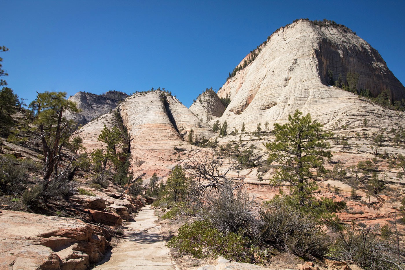
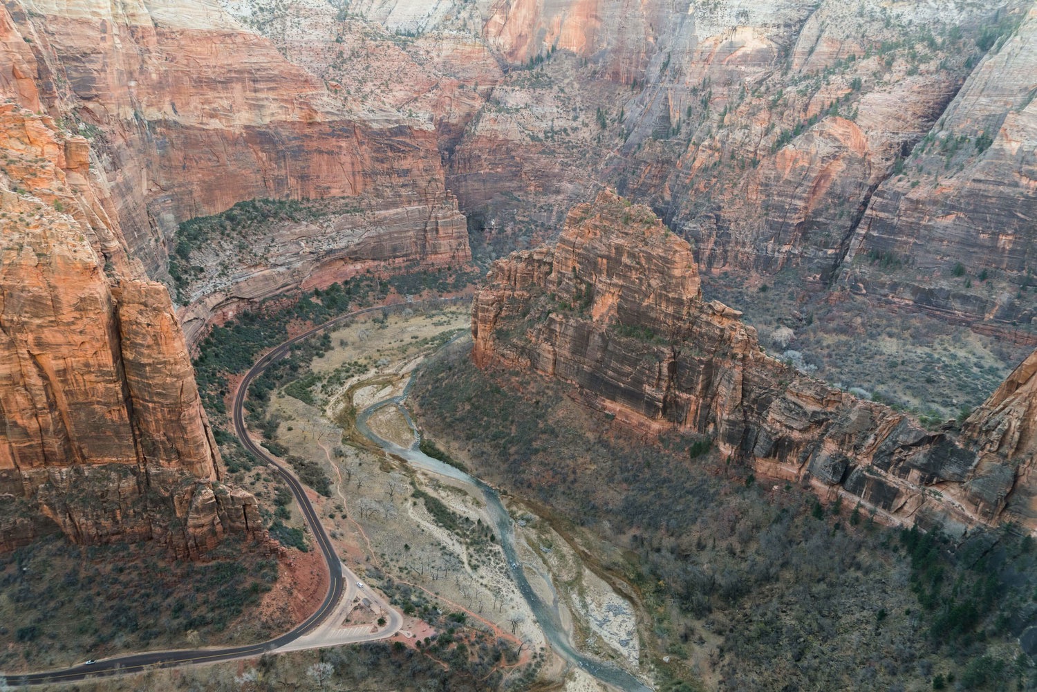
You'll be camping somewhere along here, either in Potato Hollow, Telephone Canyon or somewhere along the rim. The second day, your hike will take you along the rim, with increasingly jaw dropping views. Then you'll pass the falls shown above, and begin your descent through the White Cliffs (below). You'll come to the view bottom left, where you're looking at the back side of Angel's Landing. Suddenly the trail will pass through the narrow cleft in the rock and you'll be at the junctionof the Angel's Landing Trail. If you have the time and energy, hiking out to Angel's Landing would be a great ending to your trip. But if you do, you'll want to take off your pack and leave it here. The Razor's Edge section of the Angel's Landing hike is difficult enough without your trying to balance a 30+ pound pack. Then you'll have the amazing mile of switchbacks going down to The Grotto and trail's end. |
Camping is allowed only in designated sites and you have to reserve them in advance at the Wilderness Office. Nine sites are designated, in rising order from east to west. #9 is at Sawmill Springs, just below Lava Point. Campsites #7, #5 and #3 have a maximum capacity of four hikers. #5 and #3 are near Cabin (West Rim) Spring. #7 is near Potato Hollow Spring. Unfortunately, these are available for reservation only at the Wilderness Office, not online in advance. #2 has a maximum capacity of two hikers, so is limited to couples or two hiking buddies. However, it's secluded, private and cozy. It's near Cabin Spring. It's more than halfway, so you'd have a longer first day and a shorter second day. But you could sleep in that second morning. It's 11.2 miles from Lava Point Campground, but only 9.0 miles from Sawmill Springs camp site. This site can be reserved online in advance. |
|
|
Campsites #6 and #8 have capacities of six and can be reserved in advance online. #6 is close to the junction of the Telephone Canyon Trail with West Rim Trail. #8 is near Potato Hollow Spring. #1 or #4 are your campsites if you have a large group. They have a capacity of 12. #4 can be reserved online in advance. So, if you're alone or with one other person, we advise reserving #9 for the first night and #2 for the second. If you have a family or group of three or four we advise reserving #9 for the first night and either #7, #5 or #3 for the second. If you have a youth group we advise staying at Lava Point the first night and either #1 or #4 the second. The permit system changes frequently. We advise calling the park service office several months in advance and finding out what the rules currently are and which sites can be reserved online in advance. |
|
|||
|
.jpeg)